Wrapping up the season

One of many large chains of Chaeotoceros now blooming in Arthur Harbor.

One of many large chains of the diatom Chaeotoceros now blooming in Arthur Harbor.

Yesterday morning the Gould returned to Palmer Station, which means that it’s time for Jamie and I to take off. I’m looking forward to getting home and working through all the data we’ve collected (and who wouldn’t want to spend Christmas sick in the Drake Passage?), but sad to be leaving at an ecologically interesting point in the season. After a particularly windy spring we’ve had a week of calm conditions. As expected this resulted in a huge increase in primary production. The water at our regular sampling stations has turned green almost overnight. In an ideal world we would have seen those conditions two weeks ago, at the height of our sampling, but there’s no predicting the timing of these events! Consistent with what we’ve seen in the minor blooms all season this major bloom is composed mostly of Chaeotoceros. Instead of short chains however, we’ve got dense chains of many tens of cells. If these calm conditions persist a little longer it bodes well for the krill (and everything else) this season. To keep track of what the Palmer LTER group is up to for the remainder of the season you can check out Nicole Couto’s blog here.

All in all it was an extremely busy and productive early season.  Many thanks to everyone at Palmer Station for making it happen!

A new species of penguin clusters at the ice edge.

Celebrating the summer solstice: a new species of penguin clusters along the shoreline near Palmer Station.

Posted in Palmer 2015 field season | Leave a comment

Making sense of megafauna: The canyon hypothesis

Earlier in the week we had our orca show, yesterday this was the view of the top of our boat ramp:

A group of elephant seals lounges at the top of the Palmer Station boat ramp.

In fact that view hasn’t changed.  From the science office I can just make out the penguin colony on Torgersen Island, and there are plenty of their flying relatives around.  Does every bay on the Antarctic Peninsula look like this?  Or is there something special about the location of Palmer Station?

The answer is a little of both.  Certainly the West Antarctic Peninsula has more marine megafauna than just about anywhere else on Earth.  My experience from the Palmer LTER cruise two years ago was that seals and penguins are fairly ubiquitous along the coast.  That is not to say that they are equally distributed however, and the site for Palmer Station was selected in part for the high concentration of animals here – perhaps most visibly the Torgersen Island penguin colony.

The bathymetery of the canyon leading into Montery Bay.

The bathymetery of Monterey Canyon, terminating at the Salinas River at the head of the bay.  Image from the website of the Naval Postgraduate School at https://savage.nps.edu/Savage/Locations/MontereyBayCalifornia/_pages/page03.html.

A lot of work has gone into understanding how and why marine fauna is distributed along the West Antarctic Peninsula, and this has given rise to what is called the canyon hypothesis.  Anyone who’s ever been to Monterey Bay, California or read John Steinbeck’s famous novel Cannery Row is already familiar with the role that submarine canyons can play in marine ecology.  In the case of Monterey Bay dense schools of sardines congregate (or rather congregated, before they were all fished out) at the head of a deep marine canyon that cuts across the continental shelf.  Sardines, much like krill in the Antarctic, are a critical intermediate in the food web, being small enough to feed on nearly-microscopic plankton and large enough to serve as a practical food source for big predatory fish, seals, and whales.

Sardines concentrate at the head of Monterey Canyon because their food source concentrates there.  If we follow that logic further down the food web we reach a point where abundant nutrients, namely phosphorous, nitrogen, and silicate, support the growth of phytoplankton.  These are fed on by small zooplankton, which in turn are fed on by sardines, and the biomass is slowly channeled up the foodweb.  So the distribution of megafauna is dependent on the distribution of nutrients, but what do canyons have to do with all this?

Throughout the world’s oceans deep water is generally more nutrient rich than surface water.  In the photic zone, the portion of the water column that has enough light to support photosynthesis, nutrients are quickly used up by phytoplankton.  By contrast in the deep, dark ocean there is no photosynthesis, and the bacterial degradation of organic matter sinking out of the photic-zone releases a considerable fraction of these nutrients back into the water column.  Generally the deeper the water the older it is, and the longer it has had to accumulate nutrients.  Places in the ocean where this deep, nutrient-rich water reaches the surface are highly productive and are often famous for their fisheries.

Coastal upwelling site, where nutrient-rich deep water is returned to the photic zone. Figure taken from

Coastal upwelling sites, where nutrient-rich deep water is returned to the photic zone. Figure taken from Capon and Hutchins, 2013.  Notable upwelling sites are circled in white and include the (clockwise from top-left) California current, Canary, Benguela, and Peruvian upwelling systems.

Much of this upwelling of deep nutrient-rich water is caused by a geophysical phenomenon called Ekman transport.  Locally however, marine canyons can provide an additional opportunity for upwelling by channeling deep water onto and across the continental shelf.  Returning to Palmer Station, let’s take a look at the bathymetery of Arthur Harbor:

The Bathymetry of Arthur Harbor, reconstructed from data collected by Philippe Tortell.

The Bathymetry of Arthur Harbor, reconstructed from data collected by Philippe Tortell.  Depth is given by color and shown in meters.  Station B, one of the regular LTER sampling sites, is shown by an open circle (Station E, our other regular sampling site, is off the map along a trajectory 160 degrees from Station B).  The green area that terminates at Station B is the head of a network of marine canyons.

We have nothing like the detailed bathymetery of Monterey Canyon, probably one of the best-studied submarine canyons in the world, but you don’t need ultra-high resolution to make out the network of submarine canyons snaking into Arthur Harbor.  These canyons don’t cut to the phenomenal depth of Monterey Canyon, but due to the unique setting of the coastal Antarctic they don’t need to.  Away from the immediate coastal area surface waters around Antarctica are iron limited.  This is the result of limited dust deposition and a lack of rivers.  Because of this iron limitation nitrogen, silicate, and phosphate are less likely to be drawn down.  Submarine canyons along the West Antarctic Peninsula are able to channel intermediate-depth nutrient-rich water from offshore areas right into coastal bays and fjords.  The result is a convergence of iron-rich nearshore water and macronutrient-rich offshore water and high biological productivity.

Ashley and Chelsea take one of the Schoefield group's gliders for a test swim in advance of deployments later this month.

Ashley and Chelsea take one of the Schofield group’s gliders for a test swim in advance of deployments later this month.

Of course the penguins and seals know all this, but it’s taken us a while to figure it out.  Oscar Schofield‘s group in the Palmer LTER project has done some really amazing work with gliders to validate the canyon hypothesis; tagging penguins from Torgesen Island and programming gliders equipped with bio-optical sensors to follow the penguins to their feeding grounds.  Not surprisingly the penguins feed on krill that congregate at the head of the submarine canyon, just as sardines congregate in Monterey Bay.  We are still data-limited for much of the West Antarctic Peninsula, but there seems to be a remarkable correlation between the locations of penguin colonies and major submarine canyons, suggesting that the canyon hypothesis is not limited to Arthur Harbor.

As I’m writing this Nicole, Ashley, and Chelsea are back at Station B in an attempt to return to our bi-weekly sampling program.  Boating was shut down for most of the week from ice and/or high winds, and winds and warmer temperatures have finally succeeded in breaking up much of the fast ice in Arthur Harbor.  After six weeks our ice station is finally gone, and in less than two weeks Jamie and I will be gone as well!

Posted in Palmer 2015 field season | 2 Comments

National Geographic moment

This is a very short post to share the spectacular National Geographic moment we had this morning when a pod of killer whales swam into Arthur Harbor and spent about an hour terrorizing the local seals.  Spoiler alert for the soft hearted – they didn’t kill any.  It was fascinating behavior to observe; the clearly could have taken the seal in the video at the end of this post (shot by and posted with the permission of Chuck Kimball, the Palmer Station comms tech), but didn’t.  Just practicing?  Teaching the kids how to hunt seals?  Just having fun?  Who knows.  Everyone ran out onto the dock to watch the action and this definitely caught their attention.

An orca comes in for a closer look at the crowd on the Palmer Station dock.

An orca comes in for a closer look at the crowd on the Palmer Station dock.

This

A large male cruises the ice edge.

Posted in Palmer 2015 field season | 1 Comment

The news from Palmer Station

It’s been another quiet week at Palmer Station, out here on the edge of Antarctica…

This week was punctuated by a set of intense storms.  The one that came in on Wednesday was the most intense storm that we’ve had this season (see Jamie’s blog on the unusual winds this year here).  Just before the storm hit we made a quick run out to one of our regular sampling stations.  It was eerily quiet and the ice was drifting in.  Within an hour of our return to station the wind was up over thirty knots and the ice was coming in fast.  By the time the storm ended Arthur Harbor was chock-full of icebergs and large pieces of sea ice.  This shut boating operations down for the rest of the week.  The ice finally drifted out this morning with another (warm, wet) storm blowing from the east.  Chances don’t look good for getting out before the next storm arrives on the tail end of this one.

Whale

We got cruised – “whale watched” in Conor’s words – by this humpback whale on our last sampling trip, just before Wednesday’s storm hit.

Cut off from boating for a few days we took the opportunity to complete some side projects.  One that I’ve been particularly interested in doing is to take a look at the dense blooms of algae that form on top of the sea ice.  I’ve written quite a bit in the past on the ice algae that grow below sea ice (see here).  Wherever sea ice floods however, you also get a dense bloom at the ice surface.  Although this does happen in the Arctic this is primarily an Antarctic phenomenon.  The reason for this is that there is generally much more snow on Antarctic sea ice; the snow both insulates the ice and pushes it downward, making it warmer and more porous, and allowing seawater to infiltrate to the surface.  The reason for that is largely geographic.  One of the key distinctions between the Arctic and the Antarctic is that the latter is a continent surrounded by water.  The ring of ice around the Antarctic continent in winter eventually gives way to open water, and open water means precipitation.

We couldn’t use a boat to get a fresh chunk of ice (on account of there being too much ice), fortunately it was easy enough to get in a drysuit and wrangle one close to shore.

Jamie

Jamie keeps a lookout while I go wading after some algae-rich ice.

Scrape

Scrape the snow off of any of these floes and this is what you find; a thick ice-top algal bloom.

Conducting experiments on ice algae is non-trivial and I’m fortunate to have spent a good portion of my time in graduate school dealing with the peculiarities of sea ice biota.  One of the issues that we have to deal with is the semi-solid (emphasis on the semi for this slushy ice) nature of the sea ice matrix.  The bacteria and algae that we want to separate out for further study are located in brine channels within the ice, we need to melt the ice to get them out.  Simple enough, but consider that even for this very warm sea ice the salinity of the brine channels is roughly 37 ppt, while the bulk salinity of the ice (that is, the final salinity if you just let everything melt) is about 11 ppt (check out this open-access paper for a further explanation).  Taking the sea ice microbes from 37 ppt to 11 ppt would have induced quite a shock.  To avoid that we needed to melt slowly into a sterile, pH controlled, high salinity brine so that the final melt was about equal in salinity to the brine channels.  That done we incubated the melt outside in clear bottles for a few hours to get everything acting like it was back on the ice floe.

Ice

Happy algae obtained from a carefully controlled melt.  Surprisingly the algal community was fairly diverse, although that may be the result of recent seawater intrusion.  The dominant diatom morphotype, the pennate diatoms with the long spines, is one that I haven’t observed in any other samples this season.  Another interesting detail is the low abundance of bacteria.  There are plenty there, they are the small dots scattered across the background, but are rare relative to the number of phytoplankton.  There is some debate about a possible decoupling of primary production and bacterial production in really productive sea ice that I touch on in this open access paper.  In this case bacteria might be inhibited by the high light conditions or by the ice algae themselves.

Once we felt that everything was acclimated we threw our complete analysis suite* at it; in addition to the core LTER measurements this includes measurement of photosynthetic efficiency, the reactive oxygen species superoxide and hydrogen peroxide, samples for RNA and DNA analysis, and lipid analysis.  The main thing that I’m interested in learning from these samples is how the ice top algal community differs from that below or within the ice.  The light regimes are completely different.  Algae growing underneath the ice are generally thought to be low-light specialists.  After all only a small fraction of the light that hits the ice surface makes it through into the water below.  The light conditions at the ice surface by contrast are intense – too intense for most phytoplankton species to perform well.  Given too much light the photosynthetic machinery of phytoplankton runs amok and starts to destroy the cell.

Experiments have demonstrated that low-light adapted ice algae are quickly destroyed by ice-top conditions.  Given enough time however, the range of conditions that algae can adapt to is quite phenomenal.  So are the ice algae at the surface the same as those underneath, but physiologically adapted to high light conditions?  Or are they a different species (or assemblage of species) specially adapted to this ecological niche?  So far all we know from yesterday’s effort is that they’re making quite a lot of the reactive oxygen species hydrogen peroxide and superoxide!  We’ll learn more over the next few days as we complete more of our analyses.  The real data however, RNA and DNA sequence abundances and the lipid profiles that Jamie is working on, will take months to develop…

Not all side projects undertaken while we wait out the weather and the sea ice conditions have been research related, however.  Ashley and Chelsea, Rutgers undergraduates with the Schofield Palmer LTER group, found some time to get us all in the holiday spirit.

The chemis-tree; another US Antarctic Program infrastructure milestone.

The chemis-tree; another US Antarctic Program infrastructure milestone.

Well, that’s the news from Palmer Station, where all the seals are fat, all the penguins are curious, and all the science is above average.

*Many thanks to both the Schofield and Ducklow Palmer LTER teams for going along with crazy idea #2 for the season (#1 being the sea ice station.  #3 is still in development).

Posted in Palmer 2015 field season | Leave a comment

Sea ice redux

We were supposed to sample the regular LTER stations by Zodiac yesterday, but this was the view of Arthur Harbor as of yesterday evening:

The current view of Arthur Harbor. There will be no boating today...

The view of Arthur Harbor yesterday evening.  There will be no boating again today…

No possible way to get a zodiac through all that.  We’ll have to wait until the wind comes up (but not too much…) and blows it out.  In lieu of our regular sampling routine we made another visit to our ice station.  The ice station has been essential this year, and we feel truly lucky to have it.  We’ve made only three forays by zodiac to the regular sampling stations, but we’ve made it to the ice station six times.  Originally we only planned to visit once or twice.

Scientifically this has the potential to be a real coup.  We’ve managed to observe the onset of the spring bloom underneath the ice, in comparison with the delayed onset in open water, and a transition of the under-ice phytoplankton population from potentially mixotrophic cryptophytes to phototrophic diatoms.  Today we observed the plot thicken further still.  We knew that something was different because our filters were clogging much faster than usual, but we didn’t know what until we got back to the lab.

When we visited the ice station a week ago the phytoplankton community was largely composed of centric diatoms like these:

These are the first centric diatoms that we've seen this season, and they are quite abundant under the ice right now.

Centric diatoms from our previous visit to the sea ice station.

I spent quite a while on the microscope yesterday evening and couldn’t find a single centric diatom.  Or rather I couldn’t find a single live centric diatom.  Here’s a typical view from a water sample taken below the ice yesterday.

The large blob in the center of the image is, I’m willing to bet, the remains of one of these diatoms.  You can see a stream of cytoplasm trailing off to the right, and the bright area is what remains of the nucleus (the stain used to make the image fluoresces when bound to DNA).  They’re difficult to make out in this image, but the stream and the remainder of the cell are heavily colonized by bacteria.  While all the centric diatoms died off a number of chain-forming pennate diatoms remained, like the Chaetoceros to the left in this image.  So there was some kind of selective mortality.  At this stage we have no way of determining the cause, but my guess is a viral attack – the algal equivalent of a flu epidemic.  Phytoplankon viruses haven’t received a lot of study as of yet, in large part because of the difficulty in studying them and the complexity of phytoplankton ecology, but they probably play a major role in phytoplankton population dynamics, and by proxy the marine carbon cycle.

Later today we’ll have a sense of how much carbon the bacterial population is taking up as a result of this early collapse of the phytoplankton bloom (how much bacterial production is occurring).  My guess is it will be up quite a bit from the last time that we sampled.  Phytoplankton are the primary source of food for marine bacteria, and aged or infirm phytoplankton are quickly colonized by marine bacteria that specialize in scavenging these cells.  Cell lysis is the final step in this process, and the high quality biomass inside phytoplankton cells can fuel a lot of bacterial production.  Bacterial abundance is up and it was likely bacteria, and all the goopy cytoplasm from lysed diatoms, that clogged our filters yesterday.

Macroscopically it was an exciting sampling day as well.  The southern elephant seals seem to be abundant this year.  No one knows if the numbers are really up, or if they’ve arrived  a little earlier than usual, or if they’re just being more sociable than normal, but they’re all over the ice and the station.  Usually they don’t take much notice of people, but we attracted the attention of a small (fortunately) one yesterday.  On land elephant seals move in 10 m lurching “sprints” with very long rest periods; not the most graceful creatures out of the water.  We could see this one making a beeline towards us from a long way off, and had plenty of time to ponder what to do if it tried to join our sampling operation.  As it got closer we were relieved to see that it wasn’t a mature bull (which get territorial and can top out at well over 3 tons).  We made a line of ski poles and snowshoes, which was enough to deflect its course around us.

An inquisitive elephant seal checks out our ice sampling operation yesterday.

An inquisitive elephant seal checks out our ice sampling operation yesterday.  I have no idea no idea what might motivate an elephant seal to crawl, in 10 m increments, across several hundred meters of ice to check us out.

Elephant

Shortly after the elephant seal departed we were joined by the juvenile crabeater seal pictured below, the first of that species that I’ve seen this season (thanks to the birders for clarifying that this was a crabeater and not a leopard seal – despite the predation of the latter on the former the two species are closely related and difficult to tell apart).

DSC_0908Our last visitor was this Adélie penguin which, like most penguins, seemed mostly confused that we were not also penguins.

Conor and Jamie converse with a local.

Conor and Jamie converse with a local at our sea ice station yesterday.

If you like pictures of Adélie penguins, and really, who doesn’t, Palmer Station’s seasonal penguin cam is now operational.  Check it out to view all the stages in the penguin life cycle in all their glory…

The Palmer Station penguin cam, showing the colony on nearby Torgersen Island.

Posted in Palmer 2015 field season | 2 Comments

Up by two

We gained two more members to our team this week; Conor Sullivan, a field technician with the Ducklow group at the Lamont-Doherty Earth Observatory, and Ribanna Dietrich, a graduate student at the University of Edinburgh in Scotland.  After dropping them off (along with a massive quantity of cargo) the Gould made a fast departure to start a four-week research cruise to study fjord processes along the West Antarctic Peninsula.  Fjords are a major feature of the coastline, but haven’t received a lot of study due to the difficulty of safe access and the limited available resources.  When the Gould comes back around it will be time for Jamie Collins and I to return to Punta Arenas.

Now that we have a full team it’s time to ramp up our sampling schedule.  We’ve been pretty busy so far; in addition to our ice removal experiment we’ve already made it out to the regular Palmer LTER sampling sites by zodiac a couple of times.  This three minute video, taken on the nicest day anyone on the team can remember having in Antarctica, highlights some of the challenges of conducting a full oceanographic sampling program from a 19 foot zodiac.

Unfortunately most days this season have looked nothing like the day in the video.  As Jamie discusses in his blog here, the winds have been unusually strong this year.  That’s kept the phytoplankton bloom from developing and mostly kept us on shore (boating operations shut down when the wind reaches 20 knots).

Contrary to all expectations however, the strong winds this season haven’t broken up the land fast ice in Arthur Harbor.  Over a week ago I reported on our “last” visit to our ice station.  With the ice in good shape we were able to make another sampling foray yesterday.  I’m glad that we did, because a diatom bloom is starting to develop under the ice!  The exciting thing about that is that it’s exactly what we would expect to find.  The sea ice stabilizes the water column and keeps the diatoms from getting mixed too deep.  For many years researchers, relying primarily on satellite observations of chlorophyll a in the surface ocean, have hypothesized that the presence of sea ice plays an important role in high latitude phytoplankton bloom formation.  Direct observations of this however, are sparse.  This year, purely by chance, we’ve got the opportunity to observe a well-stabilized water column underneath sea ice adjacent to a highly mixed water column in open water.

These are the first centric diatoms that we've seen this season, and they are quite abundant under the ice right now.

These are the first centric diatoms that we’ve seen this season, and they are quite abundant under the ice right now.

Also not previously observed this season; this is a delicate chain of pennate diatoms morphologically similar to Pseudonana.

Also not previously observed this season, this is a delicate chain of pennate diatoms morphologically similar to the genus Pseudo-nitzschia.

This was the first diatom (Chaeotoceros) that we observed responding to the springtime conditions under the ice. It's a little less abundant now.

Another chain forming diatom; this was the first diatom (genus Chaetoceros) that we observed responding to the springtime conditions under the ice.  It’s a little less abundant now.

Happy Thanksgiving!

Posted in Palmer 2015 field season | Leave a comment

Enduring is easy 100 years after Endurance

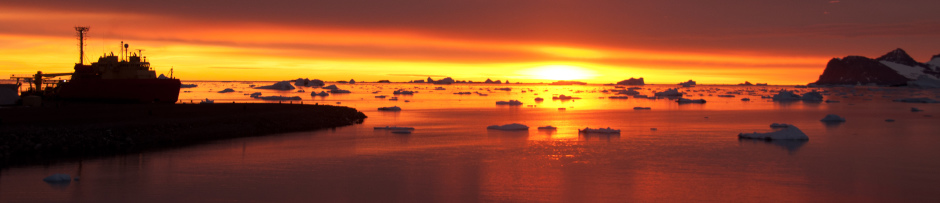
Today’s a special day in the annals of Antarctic exploration, it’s been 100 years to the day since Ernest Shackleton’s ship Endurance was crushed by ice and finally sank after 307 days beset in the pack ice of the Weddell Sea.  The disaster ended Shackleton’s hopes of leading the first team to cross the Antarctic continent, but set the stage for one of the most audacious maritime adventures of the era.  You can read more about that in Frank Worsley’s excellent book Endurance, or in Shackleton’s own book South.  Or you can take the easy way out and read the Wikipedia article here.  To mark the occasion the Royal Geographical Society has released a new set of digitized images from the expedition.  The images were digitized by scanning the photographic plates directly, the resulting resolution is extraordinary.

The Endurance, beset in the pack ice of the Weddell Sea. The Royal Geographic Society has released a new set of high resolution images from the expedition.

The Endurance, beset in the pack ice of the Weddell Sea. The Royal Geographic Society has released a new set of high resolution images from the expedition.

There are, not surprisingly, a lot of Antarctic history nerds in Antarctica, so we had a small celebration in honor of the Endurance today.  It’s also a good day to reflect on modern Antarctic science and travel.  Things have evolved a bit since 1915; the only open small boat journeys that we get to take are to our designated sample sites, and we don’t get to take them in anything approaching exciting conditions.  We also have these actual research stations to operate from; for US researchers those are Palmer Station (where I’m writing from), McMurdo Station (less a research station than a logistics hub), and the Amundsen-Scott South Pole Station (which I have not been to).  You might be asking exactly who operates these stations and how.  Where, for example, does the trash go?  What about sewage?  There are some key differences between the stations but they all follow the same operational logic (that’s a nice way of saying the operation isn’t always logical).  By request here’s a quick look at the inner workings of Palmer Station.

Palmer Station and the ARSV Laurence M. Gould.

Palmer Station and the ARSV Laurence M. Gould, as seen from a zodiac in 2013.  The building in front of the very tall antennae houses the galley, the labs, offices, and one set of dorm rooms.  The building behind it (to the left in the image) houses the generator, gym, lounge, and a second set of dorm rooms.  The building at the top of the hill houses equipment for weather and radar stations and other observing programs.

First, the basics.  Palmer Station was built by the Navy Seabees over a three year period starting in 1965.  It was purpose-built for science and, unlike McMurdo Station, was never a military station*.  Today the station is operated by something called the Antarctic Support Contract (ASC) on behalf of the National Science Foundation.  The ASC is an interesting construct and the relationship between scientists (the end-users of the stations), ASC itself, the individual ASC personnel on-site, and the National Science Foundation resembles a particularly intricate four-party dance that no one has mastered.  A lot of toes get stepped on but, in the end, a lot of science gets done.  The ASC operates as a subsidiary of a much larger logistical company and is subject to periodic rebidding.  Currently the ASC is held by Lockheed Martin, before that it was held by Raytheon.  The parent company changes but the internal structure and personnel of the ASC stay more or less the same.

The maximum capacity of Palmer Station is around 46 people, though a typical summertime population is probably closer to 40.  Most of these are ASC personnel.  At this exact moment there are 34 people at station, 24 of whom work for ASC.  Debating the merits of more or fewer ASC personnel supporting fewer or more scientists would take a much longer blog.  Suffice to say that toe’s a little bruised.  One issue is that the station is old and it takes quite a few people to keep it running (and the personnel here do a great job of that).  Another issue is that the station is set up for science groups to come in and out with a minimal time commitment.  That’s convenient for scientists, but discourages coordination among science groups or long-term investment in the system by any one group (the Palmer LTER study is a major exception to this).  Because of this two ASC personnel have full time jobs just supporting us in basic tasks; allocating space, procuring chemicals, supplies, fixing equipment, etc.

McMurdo Station has the feel of a South Dakota boom town (although I think all of those are de-booming at the moment) with a peak population around 1,200.  As a result of the potential environmental impact of 1,200 people in a somewhat-pristine coastal environment there has been some investment in environmental protection at McMurdo.  Sewage, for example, is treated in a top-of-the-line sewage treatment facility that is no different from what you’d find in any small municipality.  Unfortunately no such investment has been made at Palmer Station.  Our sewage and food waste gets a quick grind in a macerator before being released into Arthur Harbor.  While this probably doesn’t have any catastrophic impact on the local ecosystem it certainly does have some impact.  You can quickly identify the location of the sewage outfall from the gulls and penguins that congregate there (there was an elephant seal in there yesterday, Jacuzzi-like I suppose?).  And while it is certainly a bigger problem at McMurdo, the input of artificial hormones and other pharmacological products into the local seawater is a bit disconcerting.  This would be a perfect place to test new sewage treatment technology, I’m not sure why that isn’t done (oh right, $$).

Most of the other waste streams at Palmer are treated with a little more care.  Food waste that can’t get macerated (e.g. chicken bones) get burned in a barrel (okay, not much care there), virtually everything else gets transported out by ship.  Regular trash gets compressed, bundled, and disposed of in Chile.  Laboratory waste, which may contain trace amounts of nasty things, gets transported to Chile, then by cargo vessel to the United States.  Actual hazardous lab waste, broken down by type, goes out the same way every two years.

Fortunately, since we end up feeding a lot of it to the wildlife in Arthur Harbor, the quality of food at Palmer Station is very high.  There are two chefs on staff and they take it seriously.  They succeed in doing this without making it seem excessive; I recall being a bit offended that steak, lobster, and other luxury items are flown – at great expense – into McMurdo Station (yet getting scientific equipment flown in or samples out takes nearly an act of Congress).  There’s no air traffic here, everything comes in by ship, and the cuisine leans more toward the good home cooking variety.  I enjoy it with minimal guilt.

Station power comes from a surprisingly small diesel generator.  This and the backup generator keep the diesel mechanic, who also doubles as a heavy equipment operator, pretty busy.  McMurdo Station has experimented with diversifying its power sources with varying degrees of success.  It has a small (and I understand underutilized) wind farm, and early on it had a small nuclear power plant.  I’m not aware of any similar experiments at Palmer, and really, I’m not sure what else you could do.  It’s very cloudy here and it snows a lot, so solar would be a bad choice.  The station is far too small to justify nuclear, and that’s pretty unpopular these days anyway.  Plenty windy here, but there are a ton of birds, and I hear that wind turbines and birds are a bad mix.  So I think we’re stuck with diesel.

There’s one additional quirk that I think is unique to Palmer Station.  Everyone, from the station manager to the station doctor to the scientists, pitches in with housework.  Once a week you take your turn cleaning up after dinner, and every Saturday afternoon you draw an additional cleaning task out of a hat.  It can be a bit annoying when you have to stop doing science to clean, but it’s worth it for the extra sense of community.

*McMurdo Station was originally Naval Air Facility McMurdo, although the purpose of McMurdo Station has always been (mostly) scientific.

Posted in Palmer 2015 field season | Leave a comment

An end to ice (sampling)

It’s been a busy few days as we wrap up ice sampling and make the transition to sampling by boat at the regular Palmer LTER stations.  This afternoon we’ll break down the ice removal experiment we started over a week ago.  On Monday we went out for the final sampling at our ice station – though if the ice sticks around for a couple more weeks we’ll try to go out one final time to see how the spring ice algal bloom is developing.  The heavy snow cover on the sea ice has delayed the start of the bloom, however, things are starting to happen.  During our last sampling effort we lowered a GoPro camera underneath the ice to take a look.

You’ll notice a couple of interesting things about the underside of the ice.  First, it’s extremely rough.  Landfast sea ice often looks like this; the ice forms from many small flows being compressed together against the shoreline during the fall.  As a result there is a lot of “rafting” of small ice floes atop one another.  This can present some real challenges when selecting a sampling spot.  The first couple of holes that we tried to drill exceeded what we knew to be the mean thickness of the sea ice.  It took a few tries to find a representative spot.

The amount of ice algal growth in McMurdo Sound sea ice in mid-October, covered by only a few centimeters of snow, is much greater than in the Arthur Harbor sea ice, covered by 30 cm of snow, despite that fact that it is mid-November.

The amount of ice algal growth in McMurdo Sound sea ice in mid-October of 2011, covered by only a few centimeters of snow, is much greater than in the Arthur Harbor sea ice, covered by 30 cm of snow, despite that fact that it is already mid-November and Arthur Harbor is much further north than McMurdo Sound.

You’ll also notice that the ice has a distinct green color, concentrated on the lower (or higher, in the video) rafts.  That’s the start of the ice algal bloom.  If the ice was snow free the bloom would have developed by now into a thick carpet.  You can contrast the video above with the image at right of sea ice sampled from McMurdo Sound roughly three weeks earlier in the season (in 2011).  Although much thicker that ice was covered by only a few centimeters of snow.  If the Arthur Harbor ice sticks around for a couple more weeks it will develop some good growth (unless the krill come along and graze the algae down).  You might be wondering why, if the algae are limited by the availability of light, they are concentrated on the deeper rafts further from the light.  I’m not entirely sure, but I have a hypothesis.  I’ve been searching for a literature reference for this and haven’t located one yet, but I recall hearing a talk from an expert on the optical physics of sea ice describing how the sunlight that manages to penetrate sea ice reaches a maximum some distance below the ice.  This might seem counter-intuitive, but makes sense if you consider the geometry of the floes that coalesced to make the ice sheet.

One hypothesis for the vertical distribution of ice algae - and I have to caution that this is just an idea - is that the refraction of light as it passes through sea ice sets up a light maximum that is some distance below the bottom of the ice. Algae and phytoplankton would preferentially inhabit this zone.

One hypothesis for the vertical distribution of ice algae – and I have to caution that this is just an idea – is that the refraction of light (indicated in this schematic by yellow lines) as it passes through sea ice sets up a light maximum that is some distance below the bottom of the ice floes (white boxes). Algae and phytoplankton (indicated by green) would preferentially inhabit this zone.

As you can observe in the video the light is largely penetrating the ice around the edges of these floes.  The rays of light enter the water at an angle, and intersect at some distance below the ice determined by the mean size of the floes and (I’m guessing) the angle of the sun.  The depth where this intersection happens is the depth of greatest light availability.  Above this depth the water is “shaded” by the ice floes themselves.  In our case I think this depth corresponds with the depth of those deeper floes.  Unfortunately our crude hand-deployed light meter and infrequent sampling schedule are insufficient to actually test this hypothesis.  We’d need a much higher-resolution instrument that could take measurements throughout the day.  Something to think about for the future.

In the meantime Rutgers University undergraduate Ashley Goncalves, spending her Junior year with the Palmer LTER project at Palmer Station, made this short video that describes the process of collecting water for our experiment from below the ice in Arthur Harbor.  Let the boating begin!


Posted in Palmer 2015 field season | Leave a comment

No boating yet and a sneak peek at phytoplankton

The storms of the past week cleared most of the pack ice out of Arthur Harbor, although the land fast ice that we’ve been sampling from has survived.  In anticipation of the start of the boating season there was a flurry of activity yesterday as station personnel cleared off the boat ramp and got the zodiacs ready.  Unfortunately Jamie and I didn’t think to start the time lapse below until yesterday afternoon after most of the three-ring circus had died down, but you still get a sense of the activity.

There are two science groups waiting to start boating operations; our group and a group of penguin researchers (aka “the birders”).  Both groups are part of the Palmer LTER.  While we will spend the summer investigating water column processes however, the birders will spend their summer visiting the various penguin rookeries and maintaining a remarkable long term dataset of penguin population.

The birders do far more than just count penguins, they analyze diet, physiology, breeding success, and a host of other factors. The number of penguins alone however, tells an interesting story.

Taken from Ducklow et al. 2013.  The birders do far more than just count penguins; they analyze diet, physiology, breeding success, and a host of other factors. The number of penguins alone however, tells an interesting story.  Since the mid-1970’s the number of adélie penguins along the West Antarctic Peninsula (or at least at those rookeries that we can access and monitor) has declined sharply.  There are good indications that this is related to the general decline of sea ice in the area.  A high ice year like we are having right now might be good for the adélie’s but the situation is complex.  The ice has been good but the weather is also warm and wet.  Warm, wet conditions are extremely hard on adélie penguin chicks and can lead to large (at times total) breeding failures.

The birders were supposed to get their final zodiac training today, but although the harbor is clear of ice the winds are back up (gusting around 30 kts at the moment) so everything is getting shifted back.  In the meantime we will have a late night sampling another time point from the experiment that we started on Tuesday.  As I described in the previous post, for this experiment we are making use of the highly unusual ice conditions to study what happens to the microbial community when the ice is suddenly removed (as has happened to much of Arthur Harbor and the surrounding area in the last week).  Although we won’t know the results of most of our analyses for several months, we can make some interesting qualitative observations as the experiment progresses.

One of the interesting observations so far was the initial condition of the microbial community.  During a down moment yesterday I took a look at water from just 24 hours into our experiment to see what was growing (so this isn’t exactly the initial condition, but a close approximation of it).  What we found really surprised me.  Here are a couple of images that illustrate the phytoplankton community in our experiment:

By far the most abundant phytoplankton growing under the ice in Arthur Harbor right now. The size and teardrop shape suggest that it is a Cryptophyte.

By far the most abundant phytoplankton growing under the ice in Arthur Harbor right now. The size (about 10 microns) and teardrop shape suggest that it is a cryptophyte.  This is interesting because many cryptophtes are mixotrophic; in addition to undergoing photosynthesis they can consume bacteria as a source of carbon.

A small pennate diatom. This is the only one that I could find, but, this is purely speculative, like it might be dividing.

A small pennate diatom. This is the only one that I could find but, and this is purely speculative, it looks like it might be dividing.  Magnification is the same as the previous image, so I would guess that this cell is 10-20 microns in length.

The traditional wisdom would suggest that the spring phytoplankton bloom should start with diatoms.  Following the initial diatom bloom there are successive, mixed blooms of haptophytes, cryptophytes, dinoflagellates, and other groups of phytoplankton.  Observations from this time of year are very sparse however, so it is difficult to know if we are seeing something that is unique or the normal phytoplankton assemblage for this time of year.  The composition of the phytoplankton assemblage is not merely academic; it dictates how carbon will flow through the food web in a given season.  Large diatoms for example, are easily feed upon by krill, resulting in high krill biomass and more and more healthy top predators (e.g. penguins, seals, and whales).  Smaller phytoplankton (like cryptophytes) produce a more complex food web that might ultimately channel less carbon to the top trophic levels.  We will have to wait and see how the situation plays out this year…


Posted in Palmer 2015 field season | Leave a comment

The Gould, a gale, and a bit more on SAM

The Laurence M. Gould departed for Punta Arenas last night, taking Colleen with it and leaving Jamie and I on our own until reinforcements arrive in two weeks (you can check out Jamie’s blog here for more on what we’re up to this season).  That should work out fine although we’ll be very busy on sampling days – when and if we get sampling days.  We were supposed to get out today but the weather isn’t cooperating.

A small crowd gathers to send of the Gould. Colleen's enroute back to WHOI, leaving Jamie and I to handle things until reinforcements arrive in about two weeks.

A small crowd gathers to send off the Gould. Colleen’s now enroute back to WHOI, leaving Jamie and I to handle all the measurements until reinforcements arrive in about two weeks.

The ice is, or was, pretty thick in Arthur Harbor. 45 minutes after the Gould departed they'd made it this far. Eventually they cleared the harbor and made it to more open water.

The ice is, or was, pretty thick in Arthur Harbor. 45 minutes after the Gould departed they’d made it this far (you can see the same islet just behind the Gould in the previous picture). Eventually they cleared the harbor and made it to more open water.

Shortly after the Gould departed the wind started to increase.  Right now the Gould is getting 50 kt winds at the southern edge of the Drake Passage (sorry Colleen!), we’re getting a steady 35 kt wind the blew all night and should last through today.  I’m nervous about what that will do to our sampling plan.  So far the land fast ice where our ice station is has held together; it’s a nearly a meter thick and pretty well anchored to the land.  Sometime this season it’s going to give out though, and I’m hoping that we can sample from it a couple more times before that happens.

The flip side is that when the ice goes away we’ll be able to start using the zodiacs to sample at our regular stations, at least until the ice blows back in.  The worst case scenario is being in the awkward position of too much ice for the zodiacs, but no solid land fast ice from which to sample.  To get an idea of how fast things can change compare the ice conditions in the following pictures to the conditions when the Gould departed:

Four hours after the Gould departed open water is starting to appear in Arthur Harbor. The edge of the land fast ice is to the right in this image, the water is opening between the (hopefully!) stable land fast ice and the mobile pack ice.

Four hours after the Gould departed open water is starting to appear in Arthur Harbor. The edge of the land fast ice is to the right in this image, the water is opening between the (hopefully!) stable land fast ice and the mobile pack ice.  The little peninsula of ice at center-left in this image is an additional piece of land fast ice anchored to the east shore of Arthur Harbor.

And here's what it looks like this morning. The ice is pushed even further out (not that you can see very far!).

And here’s what it looks like this morning. The pack ice (beyond the ice peninsula) is pushed even further out (not that you can see very far!).

The fast departure of the ice underscores an important ecological concept that is central to this region.  The timing of the switch from ice covered to open water conditions has a major impact on the strength and timing of the spring phytoplankton bloom; the annual ecological event from which everything else derives (think of it like a burst of new green grass in the Serengeti).

Thanks to Jamie Collins for this light profile from our ice station earlier in the week. The grey line indicates the depth of the ice. The ice blocks nearly 95 % of the light that impacts the surface, the remainder is quickly extinguished in the water column.

Thanks to Jamie Collins for this light profile from our ice station earlier in the week. The grey line indicates the depth of the ice. The ice blocks about 94 % of the light that impacts the surface, the remainder is quickly extinguished in the water column.

In the springtime Antarctic phytoplankton are limited in growth only by the absence of light.  Nutrients have been replenishing all winter, there are no grazers around (yet), and the phytoplankton are relatively indifferent to temperature.  Right now at Palmer Station we have nearly 18 hours of daylight, what keeps the phytoplankton bloom from exploding right now is the ice.  Only 6 % of the light that hits the surface of the fast ice in Arthur Harbor is making its way down into the water.  That’s enough to support the growth of specialized ice algae and low-light adapted phytoplankton just below the ice, but not a major bloom deeper in the water column.  At just 10 m depth only about 0.01 % of the light that hits the surface remains; it is essentially totally dark.

So as soon as the ice departs the phytoplankton are primed to start growing.  In Arthur Harbor the wind is driving the ice away, does this mean a bloom is about to start?  Not necessarily.  For phytoplankton, what the wind gives it also takes away.  A strong wind induces strong vertical mixing in the water column.  This impact of vertical mixing on phytoplankton has been studied in places like the North Atlantic for a very long time.  Some phytoplankton can swim, but none can swim fast enough to outpace vertical mixing.  Under a stiff, sustained wind phytoplankton in the surface are mixed deep into the water column.  If they don’t go too deep that’s fine.  Below a certain point they can’t photosynthesize enough to meet their metabolic demands (we usually take this to be the 1 % light level), but like all organisms they have energy stores and can wait to get mixed back above this depth.  Pushed deep enough however, at what we call the critical depth a phytoplankton cell has insufficient energy stores to make it back to the surface.  Under these conditions, although phytoplankton may be growing at the surface, the formation of the bloom will be suppressed.

These two figures, from Ducklow et al. 2006, show the link between SAM, the sea ice anomaly, and primary production.

These two figures, from Ducklow et al. 2006, show the link between SAM, the sea ice anomaly, and primary production.

So what does this have to do with timing?  It’s no surprise that the strongest storms happen in the winter.  In low sea ice years, with less land fast ice and an earlier retreat of both land fast and pack ice, the surface of the Antarctic ocean is exposed to late winter storms and strong mixing.  Phytoplankton that have been overwintering safely in the stable water column below the ice start to grow, but are constantly mixed down below the critical depth.  Eventually this stock of phytoplankton is depleted (or much reduced), leaving insufficient numbers to initiate the bloom when conditions finally calm down.  This idea has been explored in a number of studies, including this great 1998 paper led by Kevin Arrigo at Stanford and this 2006 study led by Hugh Ducklow at the Lamont-Doherty Earth Observatory.  This latter study is particularly interesting because it implicates the Southern Annual Mode (SAM) in determining the strength of the spring bloom.  As the plot at right shows it’s clear that SAM isn’t the only thing that determines ice duration, extent, and the strength of the bloom, but it has a clear and logical role.

More recent studies have extended the link between sea ice and SAM to higher trophic levels, including krill.  One of my favorite Palmer LTER papers is this 2013 paper by Grace Saba et al., which does a great job of illustrating the link and exploring the idea in the context of climate change.  A negative phase in the SAM during the winter and springs leads to low wind and high ice conditions (a double bonus for phytoplanton).  These conditions set the stage for a strong bloom and good krill recruitment (a large number of juvenille krill being “recruited” to the sexually mature, adult size class).  A positive SAM during the winter and spring leads to low ice, high wind, and a taxonomically different and overall smaller phytoplankon bloom.  This leads to fewer krill with a direct negative impact on penguins, seals, seabirds, and whales.

Taken from Saba et al. 2013. A negative SAM leads to low wind and high ice conditions. Good for phytoplankton and by extension good for krill. A positive SAM does the opposite, suppressing the spring bloom and reducing the food available for krill.

Taken from Saba et al. 2013. A negative SAM leads to low wind and high ice conditions. Good for phytoplankton and by extension good for krill. A positive SAM does the opposite, suppressing the spring bloom and reducing the food available for krill.

This post is getting long (this is what happens when a sampling day gets weathered out) so I want to end by wrapping it back around to the current season.  As I described in a previous post things are a little different this year.  The SAM index has generally been positive with some dips into the negative.  Only for the month of October was the mean SAM negative, and not very.  Despite this there is a definite positive sea ice anomaly.  This seems to be driven by the strong, persistent El Niño in the equatorial Pacific that shows no sign of abating any time soon.  Regardless of SAM, ice conditions are good this year, in a few weeks we’ll see what that means for the spring bloom when the ice clears out for good!

Monthly mean SAM index for 2015. Taken from the NOAA Climate Prediction Center at http://www.cpc.ncep.noaa.gov/products/precip/CWlink/daily_ao_index/aao/monthly.aao.index.b79.current.ascii.table. The current sea ice conditions have defied the SAM index, underscoring the complexity of the relationship between climate, physical conditions, and the ecosystem.

Monthly mean SAM index for 2015. Taken from the NOAA Climate Prediction Center at http://www.cpc.ncep.noaa.gov/products/precip/CWlink/daily_ao_index/aao/monthly.aao.index.b79.current.ascii.table. The current sea ice conditions have defied the SAM index, underscoring the complexity of the relationship between climate, physical conditions on the ground, and the ecosystem.

Posted in Palmer 2015 field season | Leave a comment